-
Hi everyone,
As you all know, Coffee (Dean) passed away a couple of years ago. I am Dean's ex-wife's husband and happen to have spent my career in tech. Over the years, I occasionally helped Dean with various tech issues.
When he passed, I worked with his kids to gather the necessary credentials to keep this site running. Since then (and for however long they worked with Coffee), Woodschick and Dirtdame have been maintaining the site and covering the costs. Without their hard work and financial support, CafeHusky would have been lost.
Over the past couple of weeks, I’ve been working to migrate the site to a free cloud compute instance so that Woodschick and Dirtdame no longer have to fund it. At the same time, I’ve updated the site to a current version of XenForo (the discussion software it runs on). The previous version was outdated and no longer supported.
Unfortunately, the new software version doesn’t support importing the old site’s styles, so for now, you’ll see the XenForo default style. This may change over time.
Coffee didn’t document the work he did on the site, so I’ve been digging through the old setup to understand how everything was running. There may still be things I’ve missed. One known issue is that email functionality is not yet working on the new site, but I hope to resolve this over time.
Thanks for your patience and support!
You should upgrade or use an alternative browser.
Out and About (Terra, Strada)
- Thread starter roscotom
- Start date

nev..
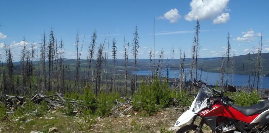
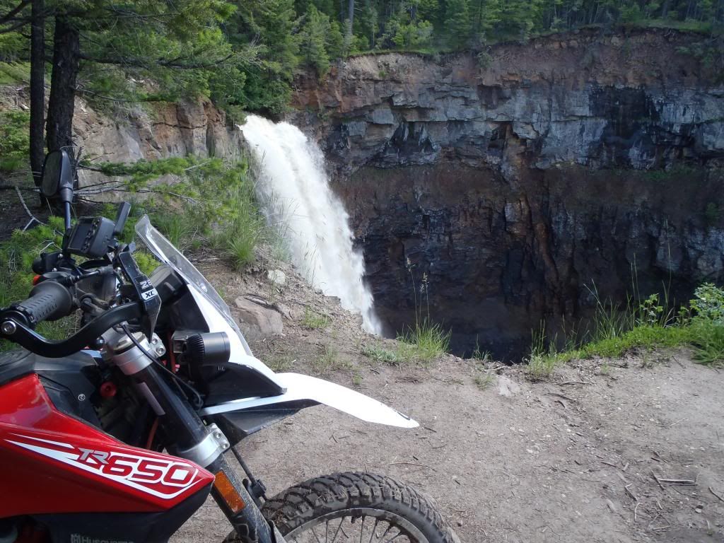
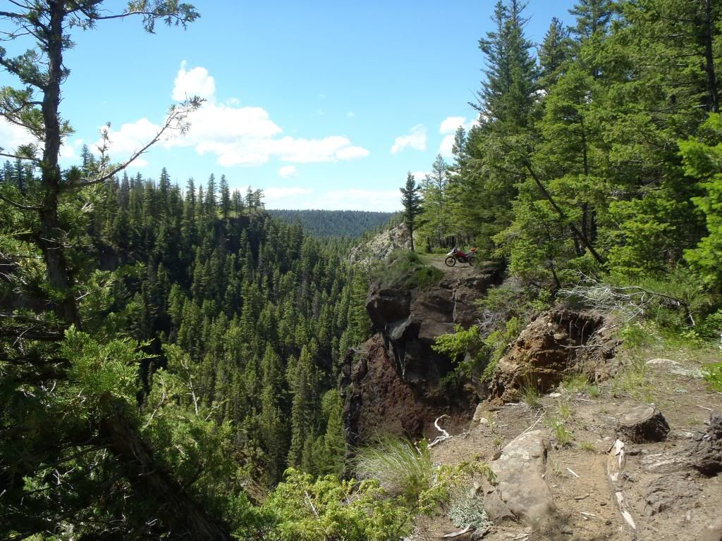
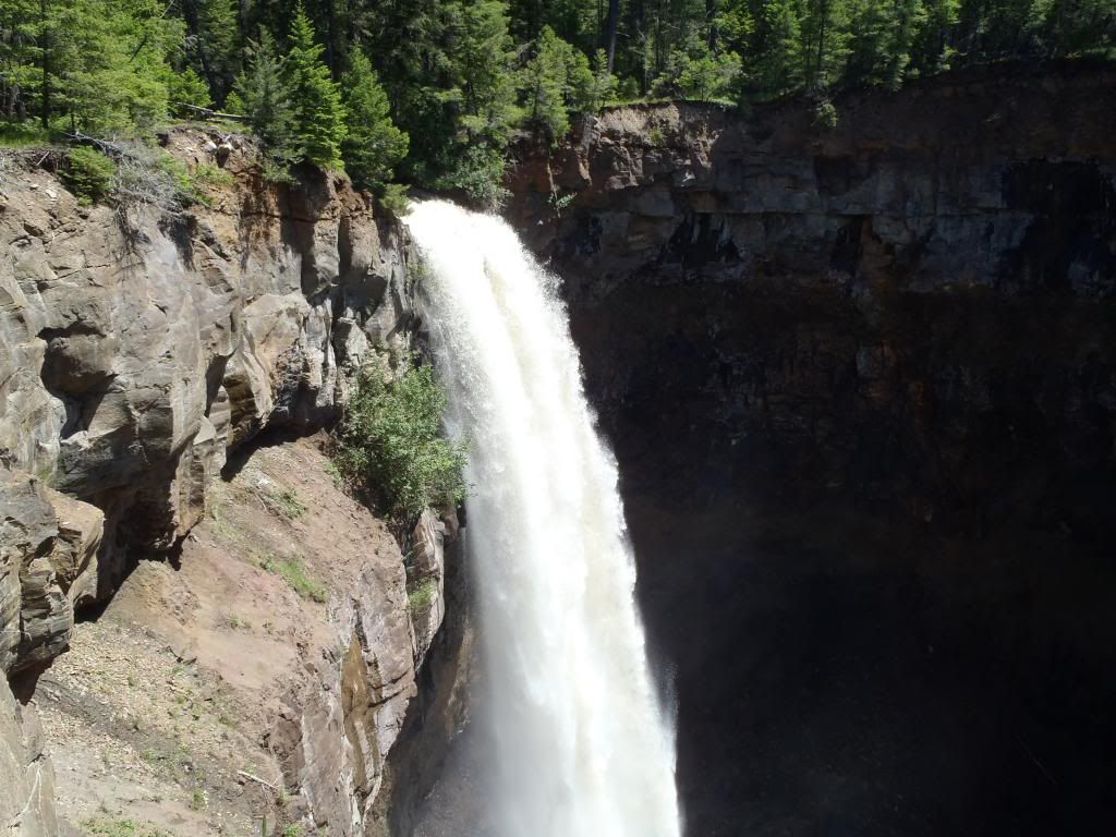
Terrarist
N 51*9'4.65" W 120*51'43.15
Deadmans Falls few hrs. North of home.
Great photos !. I like the idea of posting the GPS coords of the photos too. This could even start a game of Terra Tag... other riders can ride their Terras to the same locations.
(By the way, on a PC, hold the ALT key and type 248 using the keypad number (not the numbers at the top of the keyboard) to insert a °.)
Dinosan
Husqvarna
A Class
Well not exactly a scenic location but......
Good head turns! Is this an ARC? Looks like one of the exercises.
nev..
Terrarist
s 37.3268° e 145.1309°
Followed a 4WD track down to a creek where I had to turn the bike around and go back. The road on the other side of the creek was steep and rutted and well above my abilities.

The main road through the national park.

Just near home, the sky cleared, but a rainbow is visible (well it was more visible to me than it is in this pic).

s 37.3268° e 145.1309°
Thx nev.. for sharing your GPS Coordinates with us... Man I think we're on to something here.
I love opening Google Earth and seeing where everyone rides.

In your last pic is that fence to keep the Roos off the road?
Tazzierob
Husqvarna
AA Class
Thx nev.. for sharing your GPS Coordinates with us... Man I think we're on to something here.
I love opening Google Earth and seeing where everyone rides.
In your last pic is that fence to keep the Roos off the road?
Doubt it.... The roads would need to look like the Gaza Strip to keep those buggers in the bush...
ebrake
Husqvarna
A Class
Good head turns! Is this an ARC? Looks like one of the exercises.
Yea the organization, RideChicago, called it the intermediate rider course....equivalent to MSF ARC I believe.
nev..
Terrarist
In your last pic is that fence to keep the Roos off the road?
Nah, like Rob said it's almost impossible to keep roos off the road. There are a few freeways which have high fences for that reason but only on some very busy highways. That fence is around a water catchment for a reservoir which supplies water to Melbourne. It's there to keep people out. .
Bobzilla
Husqvarna
A Class


krussell
Strada Adventurer


After stopping at the bottom of this slide I thought it wasn't such a great idea. I didn't think I'd get enough momentum to moving and keep the Sahara hooked up to get my fat tail up the hill. Worked out fine. Walked down to get a picture of my bike at the top and ended up loosing traction in my riding boots and hitting the dirt after all. Should have stayed on the bike. It's steeper than the picture makes it out to be.


This poor guy let his mind wander. I ran into the tow guys that were going to do the recovery. They were going to use 4 - wheelers to pull him out, and if that didn't work run an excavator in. Tow operator was predicting a $2k recovery. He and his wife walked 4.5 miles up to a peak and ended up getting picked up at 1AM. They had cell phone coverage the whole time, but weren't sure where they were so it hampered efforts to get them.


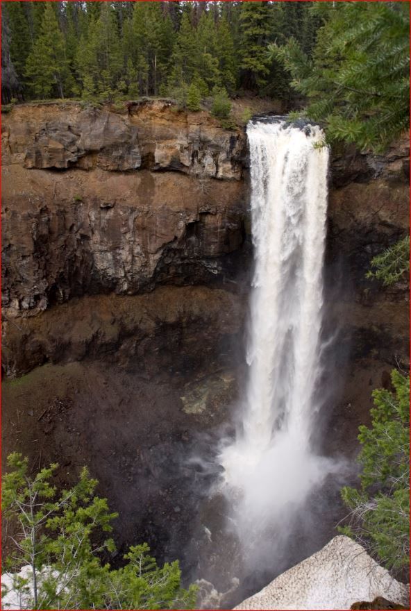
And on to the waterfall shot...

And a bit of late 1800's architecture...

And a closing shot of the forest's namesake...

Really excellent day here in Oregon.
HuskyDude suggested I add these coordinates 45°22'24.40"N 121°41'44.38"W
And I put up a track at:
http://www.everytrail.com/view_trip.php?trip_id=2210246
bmnurmi
Husqvarna
A Class
Click for location: http://goo.gl/maps/fRdp9


nev..
Terrarist
It's because you're pasting in his coordinates and he has an * where the ° should be and google can't interpret that properly.Hey HuskyDude when ever I enter your GPS coordinates in Google Earth it takes me to Manila Philipines. Thought you were just north of me?
Paste this instead N 51°9'4.65" W 120°51'43.15
Hey HuskyDude when ever I enter your GPS coordinates in Google Earth it takes me to Manila Philipines. Thought you were just north of me?
Wow I would have put money on that I changes the * for ° 's already....sorry. (Just did it now)
nev.. was nice enough to point that out on how to make °'s
This is a learning curve for me too.
And 'Thank You' Coffee for adding the files attachments. Now we just all need to figure out how to use them...
